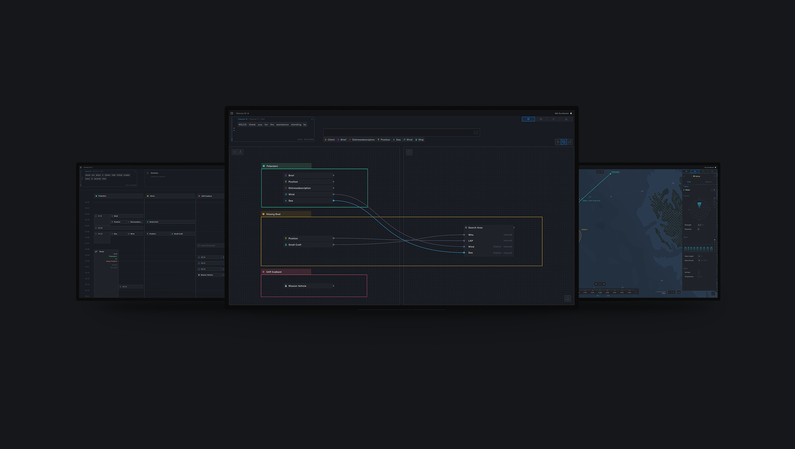
Nautilus is a modular tool for the coordination of sea rescue in the Arctic. It supports the handling and overview of limited rescue resources and support staff and communication between the many actors involved in a rescue. All tasks involved in the coordination of rescue missions can be handled centrally using Nautilus. This results in an efficient workflow which should contribute to the successful execution of rescue missions.
//PROBLEM
Future of the Arctic
The Arctic, according to the most common allocation, begins at 66° and 34min north latitude. It is an exciting area of our planet that still has a lot to discover. It contains exceptional flora & fauna such as ice algae. It also has valuable resources and new trade routes released by the effects of global warming. This arouses the interest of the riparian states and the big world powers like the USA & China. The consequences of global warming have a remarkably rapid impact on the Arctic. The phenomenon of ice-albedo-feedback is causing the Arctic ice to melt quickly, even more rapidly than scientists feared, and the Arctic environment cannot keep up with the changes. The melting of the Arctic and the imminent loss of the nordic ice landscape is attracting the attention of researchers, companies, and states.

Sea rescue in the Arctic
This interest on the part of researchers and companies follows in increased shipping traffic. This increased traffic also means increased danger for humans & environment. The conditions in the Arctic are extreme, and rescue resources are minimal. Similarly, the spillage of e.g. oil would cause much worse damage than in other parts of the world, as environmental conditions make it more difficult to contain such a disaster. For this reason, the sea rescuers are often called upon for collaborative assistance from the other riparian states. 6 countries border the Arctic. These have national borders that extend up to 200 nautical miles from the coasts. However, a large part of the Arctic is not owned by any state. This distribution of borders makes cooperation difficult, as do the different protocol standards of the states. For these reasons, there are projects like "EU Horizon 2020", which support associations and organizations like Arcsar, Arctic Council, and other organizations. These various groups work together in a collaborative network to protect the environment, people and nature. We were allowed to join the network to collect and share information and knowledge.

//CHALLENGE
The Challenge
One of the biggest tasks was to understand the complex situation of current sea rescue operations. In doing so, we had to deal with different disciplines at the same time. Through much exchange with climate researchers, heads of sea rescue, universities, and diplomatic associations, we could draw a picture of the current and yet complex situation. In addition, through textbooks, forms, interviews, and documentation, we acquired the necessary knowledge to understand the sea rescue procedure. The topic of empathy has always played a significant role. Our interview partners lived in Norway, Canada or Greenland and could therefore only conduct interviews over long distances. In order to create a better empathy to the user in this topic, we created detailed scenarios and tested situations to understand the user's actions better. Thereby we came to the following key insights:

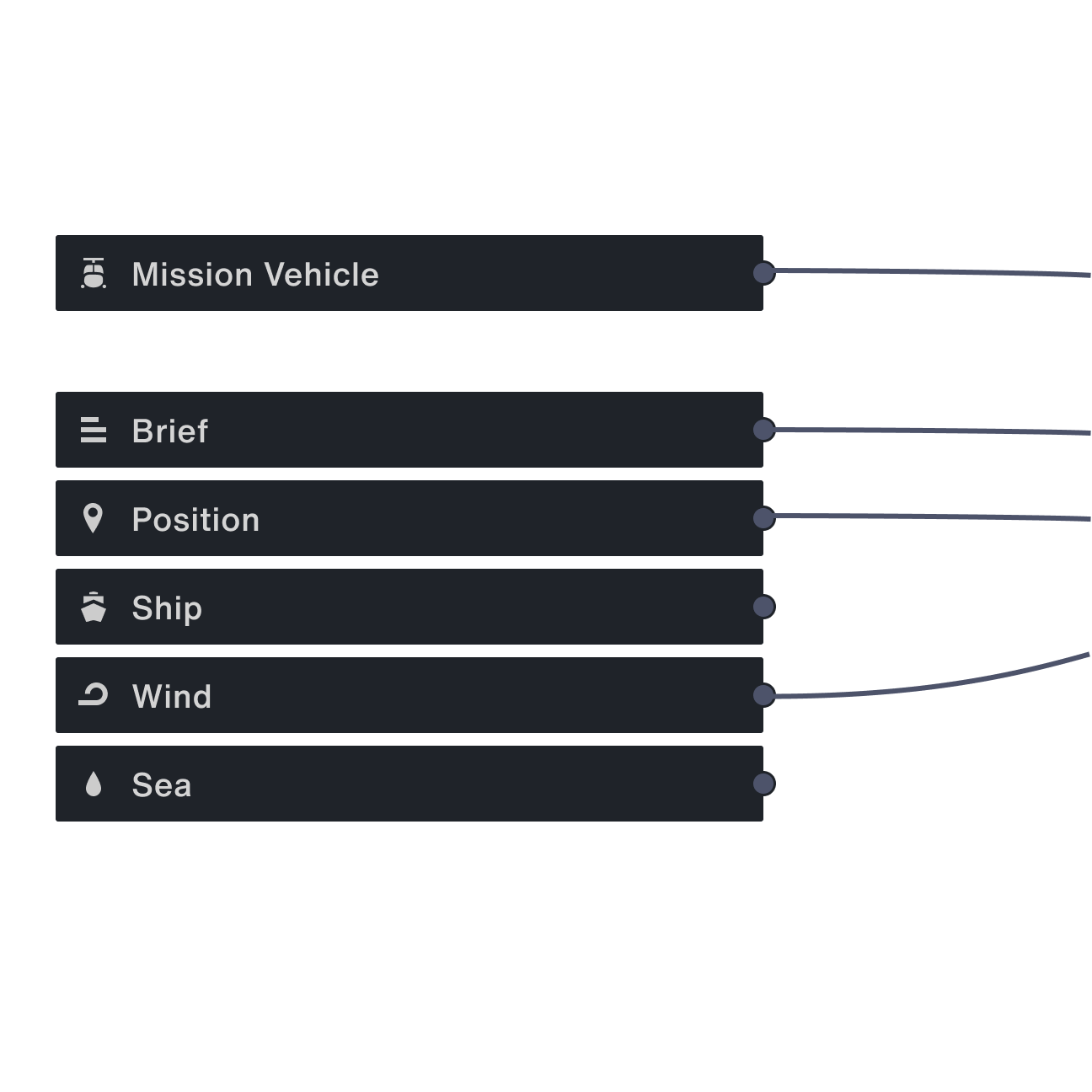
Datachaos
The current data acquisition is very different due to different data sources and the SMC can very quickly get confused. For this problem we have to unify the data sources and create data clarity by clean unification and grouping.

Communication
Communication is the most important aspect of sea rescue. The SMC directs the operation and takes care of the distribution of important information to those involved. As a hub of communication, the data can arrive in various forms. For this purpose, you have to create a seamless transition between the varied communication channels.
Generate Knowledge
The Arctic is challenging terrain for sea rescue. Similarly, there have hardly been any major operations in this area so far. The sea rescue is to record cases and to create new strategies from them. By a protocol form, which the countries can use cross-nationally and share knowledge on one platform, new strategies for sea rescue could be developed quickly.
//PRODUCT


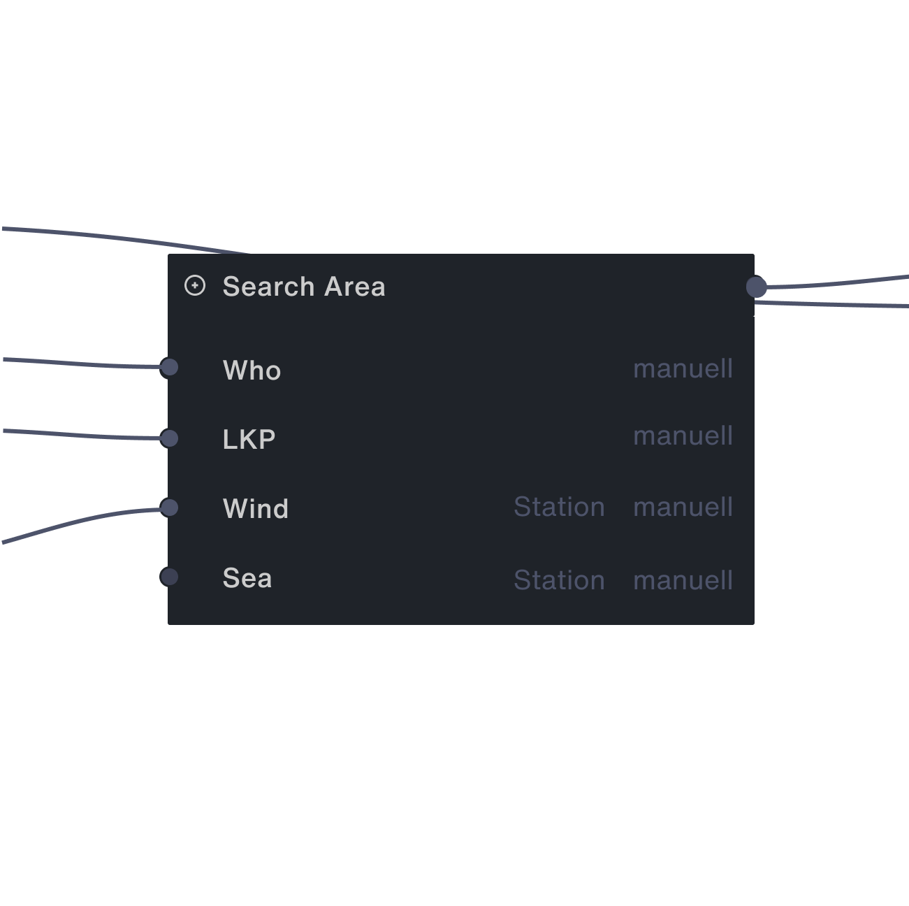
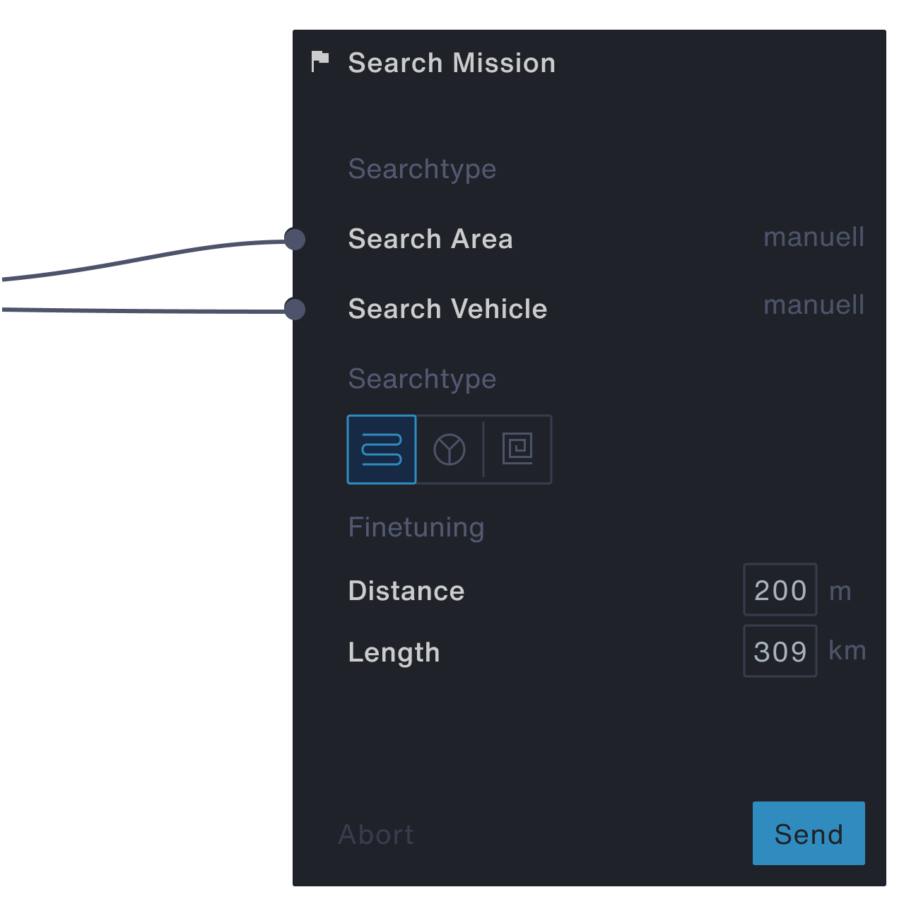
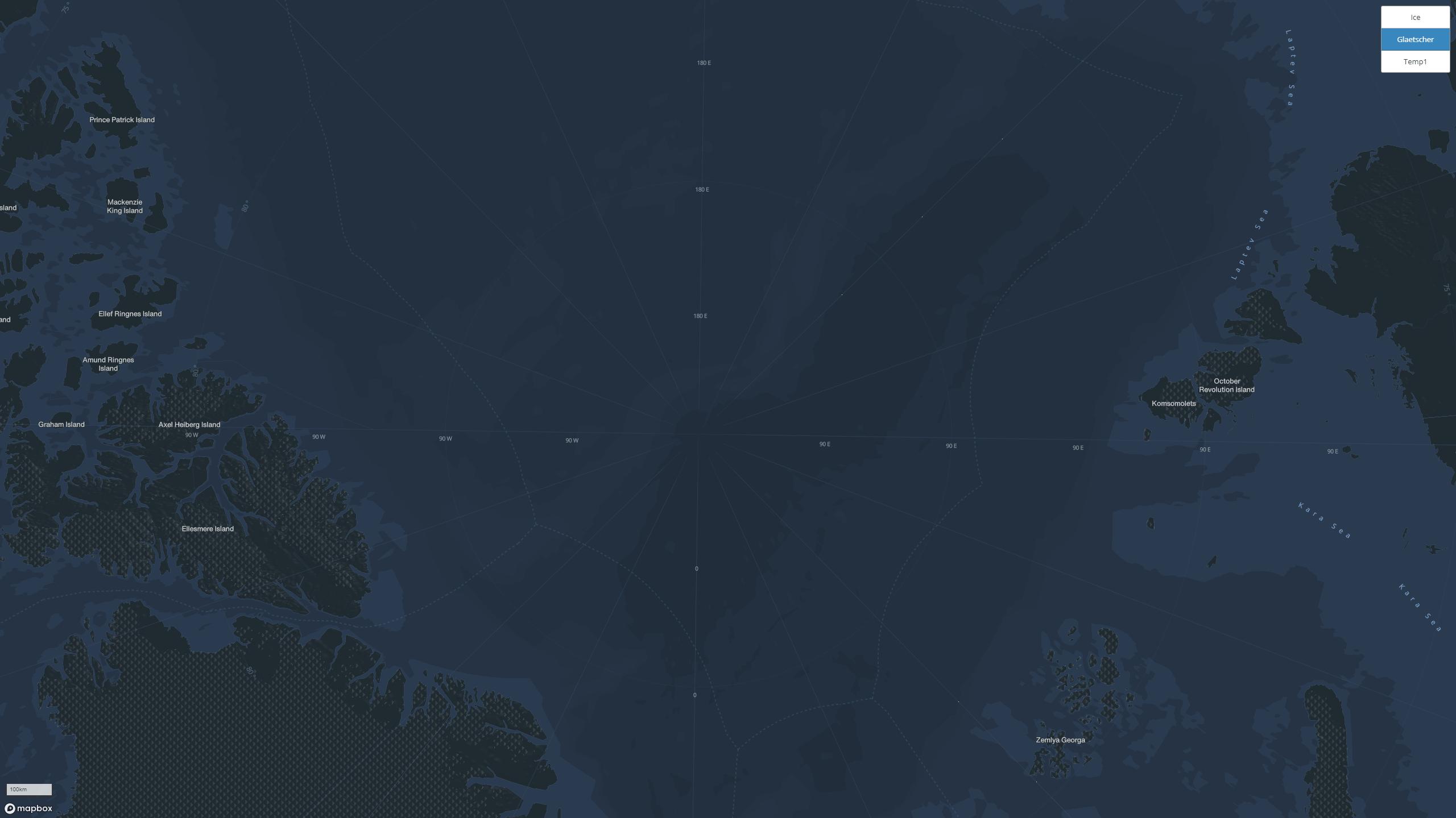
The Map
To create a functional map for sea rescue, we built a map ourselves in the azimuthal projection (EPGS:3413). This projection allows a quick overview of the Arctic and makes it easier to calculate routes and estimate distances. The problem here was that the web is only designed for the Web-Mercator (EPGS: 3857). We then created the radial map using python scripts and merged the converted datasets into Mapbox.
//VIDEOS
The Scenario
For a better idea of how to use the tool, we have created a detailed scenario. In this scenario, a research vessel's boat disappeared during a research mission. The SAR team from Svalbard will be assisting in the search. This scenario covers, in short form, all essential steps of a sea rescue.
//TEAM
//CONTEXT
- 7th Semester
- Bachelorthesis
- HfG Schwäbisch Gmünd
- WS2019/20
//SUPERVISOR
- Prof. Hans Krämer
- Prof. Marc Guntow